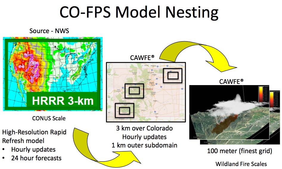
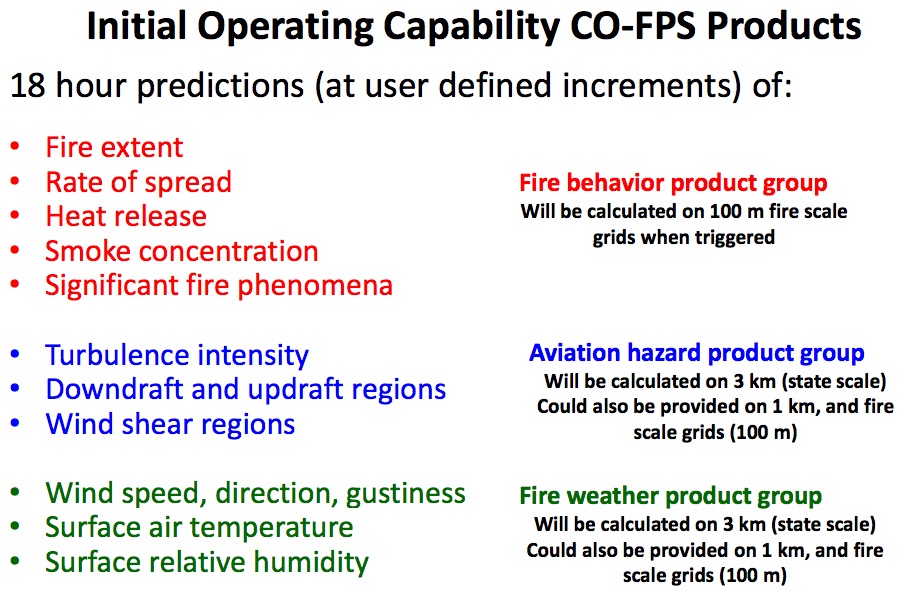
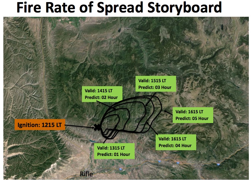
The decision support system that Colorado is developing is expected to provide frequently updated fine-scale predictions of weather that affects wildfires, and the behavior of going fires. It will use heat detected by satellites and hourly weather forecast updates from the National Weather Service to produce maps showing fire managers where multiple fires are expected to spread in the next 12 to 18 hours.
Much of the work is being done under contract for the state by the National Center for Atmospheric Research, a federally funded program headquartered in Boulder, in cooperation with the University Corporation for Atmospheric Research. The organizations have distributed a detailed briefing document on the development schedule and a time line for deliverables, which you can read HERE (1.9 MB).
Below are a few images from the document.
—————
—————
We have criticized the state of Colorado for not having their crap together for organizing and planning for the management of wildfires or for on-the-ground fire suppression, but they are developing some significant resources for gathering intelligence with their new fixed wing aircraft and now with this decision support system that will provide frequently updated predictions of fire spread using state of the art technology.
Their next logical step is to develop a management system and the firefighting resources to make use of this wealth of information. While there are some firefighting organizations that could use this data to their advantage and convert it to actions on the fire ground, at this stage it’s like *putting lipstick on a pig, at least within the Colorado Division of Fire Prevention and Control.
*In 1992 Ann Richards, the former Governor of Texas, said at a South Dakota barbecue, “You can put lipstick on a hog and call it Monique, but it is still a pig”.
Thanks and a tip of the hat go out to Bean.